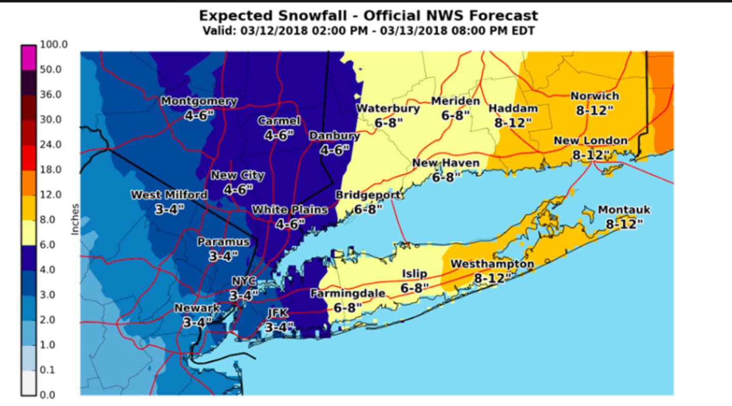
The latest snowfall projections for the third Nor'easter that will hit the area in a 12-day span once again show a range of 3 to 6 inches of accumulation for most of the tristate, but areas in Fairfield County along the coast could now see up to 8 inches, according to the National Weather Service. (See image above.)
In addition, farther west and north, Orange County went from 3-4 projected inches Sunday morning to 4-6 in the new projections released late Sunday afternoon.
Clouds will increase on Monday with a high in the low-40s and wind-chill values between 20 and 30. There is a slight chance of rain and snow before 7 p.m., followed by snow in the evening and overnight with new snow accumulation of 1 to 3 inches possible overnight.
Snow will continue until around 1 p.m. Tuesday with new accumulation of another 1 to 3 inches possible. There's a chance of a bit more snow until around 7 p.m. Tuesday.
Wednesday will be mostly cloudy with a high near 40 and a slight chance of morning and late afternoon and early evening snow showers.
Thursday will be partly sunny with a high around 40.
There is still some uncertainty with snowfall amounts, depending on the storm track. Check back to Daily Voice for updates.
Click here to follow Daily Voice Orangetown and receive free news updates.